-
Tips for becoming a good boxer - November 6, 2020
-
7 expert tips for making your hens night a memorable one - November 6, 2020
-
5 reasons to host your Christmas party on a cruise boat - November 6, 2020
-
What to do when you’re charged with a crime - November 6, 2020
-
Should you get one or multiple dogs? Here’s all you need to know - November 3, 2020
-
A Guide: How to Build Your Very Own Magic Mirror - February 14, 2019
-
Our Top Inspirational Baseball Stars - November 24, 2018
-
Five Tech Tools That Will Help You Turn Your Blog into a Business - November 24, 2018
-
How to Indulge on Vacation without Expanding Your Waist - November 9, 2018
-
5 Strategies for Businesses to Appeal to Today’s Increasingly Mobile-Crazed Customers - November 9, 2018
Google Street View to map urban air pollution
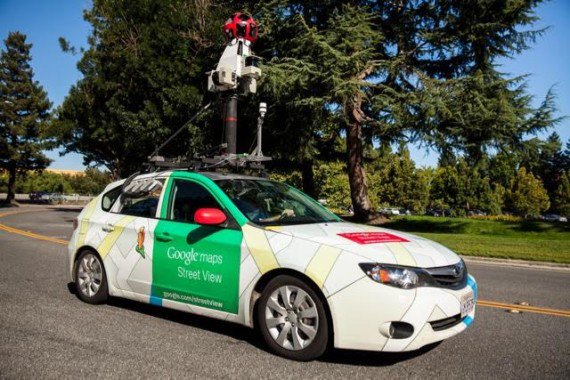
Image: Google Street View cars equipped with Aclima’s mobile sensing platform. That’s because the search giant has partnered with an air quality technology company by the name of Aclima to equip some vehicles in its fleet with special equipment to monitor air quality.
Advertisement
Now, instead of taking panoramic pictures of everything it can, Google Street View is now mapping that which the eye cannot see.
This project took place in Denver, CO where 3 of Google’s cars were given the Aclima sensors and allowed to cruise around the city gathering info about the particles in the air.
Google expands Street View to map air quality and pick up on the fine particularities of air pollution that varies from street to street, from neighborhood to neighborhood.
“They measured for chemicals that are hazardous to breathe, like nitrogen dioxide, nitric oxide, ozone, carbon monoxide, carbon dioxide, methane, black carbon, particulate matter, and Volatile Organic Compounds (VOCs)”, Tech Crunch reports.
Aclima devised three Google Street View vehicles to carry out system test for a month in the Denver metro area as part of DISCOVER-AQ study undertaken by NASA and the US Environmental Protection Agency (EPA). “With more than half of the world’s population now living in cities, environmental health is becoming increasingly important to quality of life”.
The mobility of the cars is a huge asset, as the EPA has stationary sensors for air pollution monitoring located in urban areas, but were never able to obtain street-level measurements.
“We hope this information will enable more people to be aware of how our cities live and breathe and join the dialogue on how to make improvements to air quality”, Karin Tuxen-Bettman, a Google Earth Outreach program manager, says in a statement. Understanding these complex relationships, he added, is critical to managing and improving air quality.
“There’s unlimited potential for our work to help improve the health and resilience of communities everywhere”, Herzl said.
Advertisement
Aclima says that its Denver trial was a proof of concept that’ll help it to scale up the partnership. The Sensory Science system is a sensor that monitors and maps both indoor and outdoor air quality, and can do so for a single building or a whole city. Together they created a unique network that connects 21 Google offices around the world, and processes 500 million data points daily, including comfort measures of temperature, humidity, noise, and light, and air pollutants like carbon dioxide and particulate matter.


