-
Tips for becoming a good boxer - November 6, 2020
-
7 expert tips for making your hens night a memorable one - November 6, 2020
-
5 reasons to host your Christmas party on a cruise boat - November 6, 2020
-
What to do when you’re charged with a crime - November 6, 2020
-
Should you get one or multiple dogs? Here’s all you need to know - November 3, 2020
-
A Guide: How to Build Your Very Own Magic Mirror - February 14, 2019
-
Our Top Inspirational Baseball Stars - November 24, 2018
-
Five Tech Tools That Will Help You Turn Your Blog into a Business - November 24, 2018
-
How to Indulge on Vacation without Expanding Your Waist - November 9, 2018
-
5 Strategies for Businesses to Appeal to Today’s Increasingly Mobile-Crazed Customers - November 9, 2018
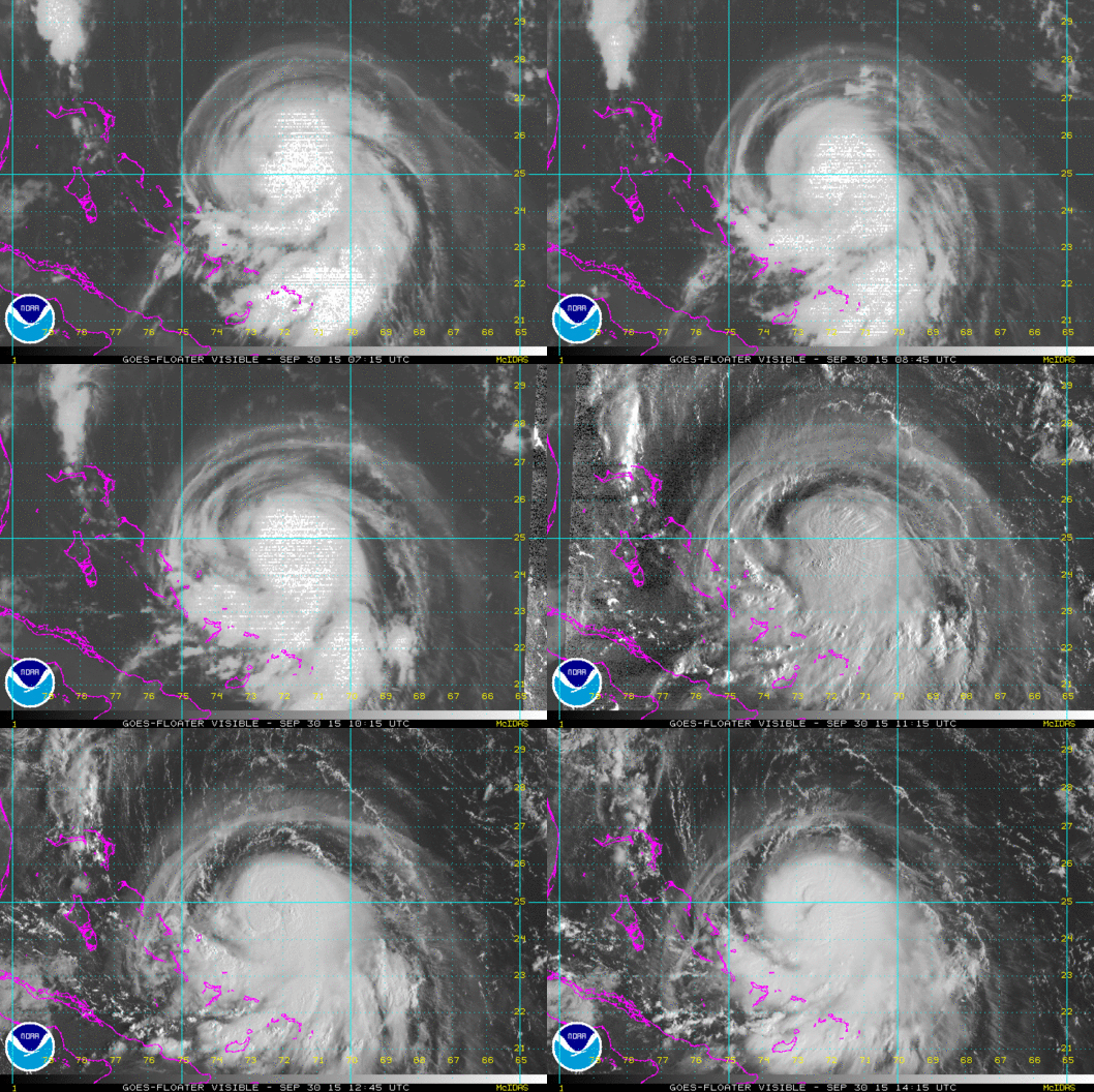
Hurricane Joaquin could head to NYC area
Joaquin could become a major hurricane Friday as it tears through the Bahamas, and while models disagree what will happen next, forecasters at the National Hurricane Center said they can’t rule out a strike on the U.S. East Coast as early as Sunday.
Advertisement
Joaquin’s center was spinning 190 miles (305 kilometers) east-northeast of the central Bahamas.
Additional strengthening is expected, and Joaquin could become a major hurricane during the next couple of days, the service said in a post on its Facebook page this morning. The storm is moving to Southwest at 7 miles per hour with a minimum pressure of 954 mb.
“I cannot stress enough the imperative for Virginians to focus on the rainstorms that are headed our way tomorrow and Friday, well before Hurricane Joaquin could potentially impact Virginia”, said Governor McAuliffe. Flooding concerns would apply to most of our area with a few severe flooding possible.
People on the islands of the eastern Bahamas are getting ready for Hurricane Joaquin, removing stray coconuts and other debris from their yards and putting up storm shutters in blustery winds. If the storm travels a bit more to the east in the Cone of Uncertainty, we’ll likely see a few bands of rain, tidal flooding and high surf.
As Hurricane Joaquin approaches, it will produce a strong easterly wind.
Rainfall totals from late Thursday into early Sunday could reach 2-3 inches, with higher amounts predicted farther east and north, Ross said. The storm is expected to strengthen over the next two days.
“A significant adjustment to the forecast has been made this afternoon, and this shows an increased threat to the mid-Atlantic states and the Carolinas”, said Senior Hurricane Specialist Jack Beven in a Wednesday afternoon forecast discussion message.
Hurricane Joaquin is building speed and getting stronger, upgrading to a Category 3 hurricane.
The hurricane center’s range of possibilities still includes possible landfall from North Carolina to Long Island and confidence in the forecast remains low, but if the westward trend continues it would work in favor of New Jersey if not the Virginia Tidewater.
Advertisement
Even if Joaquin veers away from the coast, he added, “there will still be a non-tropical component of the storm that delivers minor to moderate coastal flooding and stiff winds over a broad area from the Carolinas to the New England coast”. Sustaining winds of up to 85 miles per hour, Joaquin is expected to reach the Bahamas within the next day. Forecasts rely on models, and the models on this one are all over the place.


