-
Tips for becoming a good boxer - November 6, 2020
-
7 expert tips for making your hens night a memorable one - November 6, 2020
-
5 reasons to host your Christmas party on a cruise boat - November 6, 2020
-
What to do when you’re charged with a crime - November 6, 2020
-
Should you get one or multiple dogs? Here’s all you need to know - November 3, 2020
-
A Guide: How to Build Your Very Own Magic Mirror - February 14, 2019
-
Our Top Inspirational Baseball Stars - November 24, 2018
-
Five Tech Tools That Will Help You Turn Your Blog into a Business - November 24, 2018
-
How to Indulge on Vacation without Expanding Your Waist - November 9, 2018
-
5 Strategies for Businesses to Appeal to Today’s Increasingly Mobile-Crazed Customers - November 9, 2018
More Iowa cities mobilizing for flooding along Cedar River
Another eastern Iowa river, the Shell Rock, also has forced evacuations as it left its banks.
Advertisement
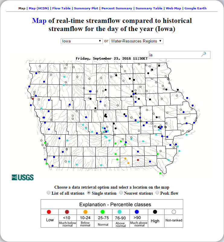
Authorities in several Iowa cities were mobilizing resources Friday to handle flooding from a rain-swollen river that has forced evacuations in several communities upstream, while a Wisconsin town was recovering from storms now blamed for two deaths. “It could be relocation, it could be moving to higher ground or it could be simply sandbags”, Cedar Rapids Mayor Ron Corbett said at a news conference Thursday afternoon.
“We have four days to get ready, and now is the time to start”. Sandbags are available in moderation at the Public Works Building located at 625 Glenwood Ave. and at the Iowa Department of Transportation maintenance garage on West Ridgeway Avenue. Pre-emptive road closures are expected Saturday.
Cedar Rapids property owners can see if their property will be impacted using the city’s flood stages map, which shows what parts of the city will be impacted at a 24-foot flood stage.
City officials encouraged residents and businesses to prepare.
The city is expected to make decisions about whether to evacuate low-lying areas Sunday morning. “If you believe experience is the best teacher, we’ve had a chance to learn a lot since that 2008 event”.
Officials with the center also have posted a new six-minute video tutorial about the various online services available. This year’s predicted crest in Cedar Rapids would be seven feet lower, but it would still be the second-highest river crest in recorded history.
Some bridges in Waterloo and Cedar Falls were being closed and residents in low-lying areas notified Friday morning as the National Weather Service raised the projected crest levels for both cities after overnight and early morning rain. The river crested 14.1 feet above flood stage in 2008. Flood stage is 88 feet.
Also, the Alzheimer’s Association has made a decision to reschedule its annual Waterloo Walk to End Alzheimer’s, originally scheduled for Saturday, to October 15. The Cedar River reached 27 feet in Waterloo eight years ago. The warning follows heavy rain in southern Minnesota and Wisconsin and northeast Iowa.
Advertisement
Contributing: The Associated Press. At the rate we’re going now, experts say 2016 will beat 2015 for the title of warmest year ever.


