-
Tips for becoming a good boxer - November 6, 2020
-
7 expert tips for making your hens night a memorable one - November 6, 2020
-
5 reasons to host your Christmas party on a cruise boat - November 6, 2020
-
What to do when you’re charged with a crime - November 6, 2020
-
Should you get one or multiple dogs? Here’s all you need to know - November 3, 2020
-
A Guide: How to Build Your Very Own Magic Mirror - February 14, 2019
-
Our Top Inspirational Baseball Stars - November 24, 2018
-
Five Tech Tools That Will Help You Turn Your Blog into a Business - November 24, 2018
-
How to Indulge on Vacation without Expanding Your Waist - November 9, 2018
-
5 Strategies for Businesses to Appeal to Today’s Increasingly Mobile-Crazed Customers - November 9, 2018
Storm Frank to bring heavy rain and wind on Wednesday
Tuesday – two days away for anyone who temporarily forgot that today is Sunday – promises to bring heavy rain and strong winds to the south, west and north of the country.
Advertisement
Most of the country will be at risk but the worst affected areas are predicted to be south Wales along with Anglesey, Gwynedd and the Carmarthenshire area.
To check up to date flood warnings, visit the Environment Agency’s website here.
A Flood Warning in in place in Maghull.
Confirmation on whether or not the weather system will be strong enough to be called “Storm Frank” will come later this afternoon.
Storm Frank is the sixth storm of the season, following Abigail, Barney, Clodagh, Desmond and Eva – in that order.
The mid belt of Scotland from Glasgow to Edinburgh could see up to six inches (150mm), while some exposed parts of Southwest Scotland could receive between 100mm and 150mm of rain.
The Met Office has issued weather warnings for wind, followed by heavy rain.
Rainfall between Monday and Wednesday will be between 30 to 60mm with further flooding expected in some areas. Gusts of 55-65 miles per hour are likely quite widely, with gusts reaching 70-80 miles per hour in exposed areas.
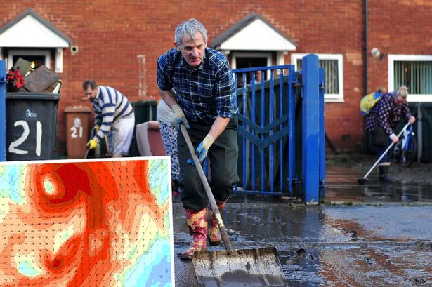
Flood-hit areas are being warned to brace themselves for more heavy rain as Storm Frank passes over the region.
“The rain will be heaviest in the west. It will gradually clear eastwards through the late afternoon and evening”.
“Everyone should be aware of the potential for disruption in places from further flooding and the impacts of the gales to transport, especially in areas such as southern and central Scotland and Cumbria where Amber “be prepared” warnings are in place”.
“The weather is particularly unsettled at the moment and we advise everyone to stay up to date with the latest Met Office forecasts and warnings and find out what to do in severe weather so they can plan ahead for the expected weather before it arrives”.
Advertisement
The Met Office has now named the storm which will hit the north west of the United Kingdom on Tuesday and Wednesday.


