-
Tips for becoming a good boxer - November 6, 2020
-
7 expert tips for making your hens night a memorable one - November 6, 2020
-
5 reasons to host your Christmas party on a cruise boat - November 6, 2020
-
What to do when you’re charged with a crime - November 6, 2020
-
Should you get one or multiple dogs? Here’s all you need to know - November 3, 2020
-
A Guide: How to Build Your Very Own Magic Mirror - February 14, 2019
-
Our Top Inspirational Baseball Stars - November 24, 2018
-
Five Tech Tools That Will Help You Turn Your Blog into a Business - November 24, 2018
-
How to Indulge on Vacation without Expanding Your Waist - November 9, 2018
-
5 Strategies for Businesses to Appeal to Today’s Increasingly Mobile-Crazed Customers - November 9, 2018
Storm Jonas Heads to Manchester
There are warnings for the areas in the United Kingdom that have already suffered from severe flooding but the Met Office said these could be extended to south-west and south-east England.
Advertisement
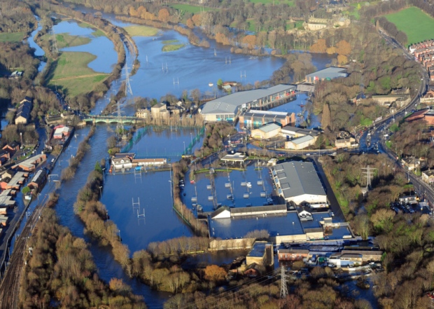
Lancashire, Cumbria and Yorkshire were among the areas worst affected last month by Storm Desmond, which ruined thousands of homes and businesses and forced residents to leave flooded properties.
Many parts of the warning area could see up to 10cm (4in) of rain, while in the northwest, southwest Scotland and north Wales as much as 20cm (8in) of rain could fall.
The rain could cause rising river levels and some flooding along the rivers Severn and Wye.
Wherever Jonas does strike it is unlikely to bring snow, unlike in the United States where up to 40 inches fell over Friday/Saturday, bringing the east coast to a standstill.
Matt Crump from the Environment Agency said: “We are expecting heavy rainfall and winds coming in from the west and urge communities to be prepared for the risk of flooding”.
Sussex faces more torrential rain and strong gusting winds as the killer blizzard that battered America heads for the United Kingdom tomorrow (Tuesday January 26).
A status yellow wind warning has been issued, with gusts of up to 110 km/h and possibly even stronger in Atlantic coastal areas expected to hit parts of the country tonight. A second low pressure system will bring Wednesday’s rain and wind.
Persistent and sometimes heavy rain is likely to lead to river flooding and standing water on roads, says the Met Office warning.
The Environment Agency has put flood alerts in place for the Rivers Aire and Calder, with the areas around Sowerby Bridge and Hebden Bridge at risk and an incident room set up in Leeds.
“And because we’ve had so much rain falling on already saturated ground, some of the areas experiencing that will be the ones who have experienced flooding already”.
Scott Squires, Duty Tactical Manager for Natural Resources Wales, said: “We are monitoring the situation closely as the ground is still fairly sodden after Christmas”.
At least 13 people were killed in weather-related auto crashes in Arkansas, North Carolina, Kentucky, Ohio, Tennessee and Virginia on Saturday.
Advertisement
A state of emergency was declared with individual states in near-shutdown after thousands of flights were cancelled, schools and government offices closed and sports and entertainment events called off.


