-
Tips for becoming a good boxer - November 6, 2020
-
7 expert tips for making your hens night a memorable one - November 6, 2020
-
5 reasons to host your Christmas party on a cruise boat - November 6, 2020
-
What to do when you’re charged with a crime - November 6, 2020
-
Should you get one or multiple dogs? Here’s all you need to know - November 3, 2020
-
A Guide: How to Build Your Very Own Magic Mirror - February 14, 2019
-
Our Top Inspirational Baseball Stars - November 24, 2018
-
Five Tech Tools That Will Help You Turn Your Blog into a Business - November 24, 2018
-
How to Indulge on Vacation without Expanding Your Waist - November 9, 2018
-
5 Strategies for Businesses to Appeal to Today’s Increasingly Mobile-Crazed Customers - November 9, 2018
Tropical Storm Julia surprises Florida, forecasters with strengthening
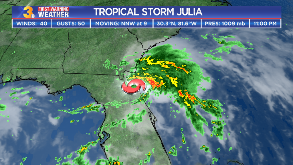
An area of disturbed weather straddling the Florida Coast was upgraded to Tropical Storm Julia late Tuesday evening. Maximum winds were 40 miles per hour as of 5:00 am, making this a minimal tropical storm.
Advertisement
Tropical Storm Julia formed late Tuesday *over* Florida, the first time in recorded history a storm has formed over Florida rather than over water.
Julia is expected to produce heavy rain however, with up to 150 mm possible near the Georgia and SC coastlines through Friday afternoon.
The National Weather Service has issued a Tropical Storm Warning from Ponte Vedra Beach to Altamaha Sound, Georgia, though 11 p.m. Wednesday.
Heavy rain is expected to continue through the night and into Thursday. And Julia could also spin off a tornado in coastal Georgia and the southern edge of SC, the center warned.
The storm was located near Brunswick, Georgia, at 8 a.m. Wednesday. Otherwise, easterly winds are not likely to become much of an issue with speeds in the 10s and 20s miles per hour most likely.
“A tropical low pressure system over northeastern Florida has now become Tropical Storm Julia”, AccuWeather Meteorologist Jordan Root said. Though it brought heavy rains to the Jacksonville area throughout the night, there was little apparent damage.
Julia is the third tropical system to make landfall across Florida this season, following Hurricane Hermine in early September and Tropical Storm Colin in June. Florida Gov. Rick Scott urged residents to review and evacuation plan just in case.
This storm continues to move north of Jacksonville, but much of the rain is out to sea.
“We know that heavy rainfall is expected across northeastern Florida between Daytona Beach and the Florida – Georgia border for the next several days”, Scott said.
Advertisement
Watch updates on Tropical Storm Julia here.


