-
Tips for becoming a good boxer - November 6, 2020
-
7 expert tips for making your hens night a memorable one - November 6, 2020
-
5 reasons to host your Christmas party on a cruise boat - November 6, 2020
-
What to do when you’re charged with a crime - November 6, 2020
-
Should you get one or multiple dogs? Here’s all you need to know - November 3, 2020
-
A Guide: How to Build Your Very Own Magic Mirror - February 14, 2019
-
Our Top Inspirational Baseball Stars - November 24, 2018
-
Five Tech Tools That Will Help You Turn Your Blog into a Business - November 24, 2018
-
How to Indulge on Vacation without Expanding Your Waist - November 9, 2018
-
5 Strategies for Businesses to Appeal to Today’s Increasingly Mobile-Crazed Customers - November 9, 2018
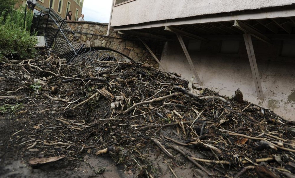
Waldo Canyon mud and debris flood Colorado Springs area
Expect more showers and thunderstorms, which could threaten the already saturated grounds in the Colorado Springs area.
Advertisement
City Hall was evacuated at 12:46 p.m. Monday.
Officials say up to 2 inches of rain fell in just 45 minutes. Such heavy rains can flood overnight.
Flash floods impacted entire neighborhoods. These storms were capable of producing hail and winds above 60 miles per hour. Local fire departments sent out a tweet on social media saying numerous rescue efforts were in effect.
West of there, in Manitou Springs, video shows how close the water came to flooding a spa. The residents heard flood siren sounds in the streets, according to CBS.
That put this year’s rain total at 21.91 inches, which is the 10th highest in Colorado Springs history (dating back to 1872), said meteorologist Mark Wankowski of the National Weather Service in Pueblo.
“A closures” are Lover’s Lane closures and Canon Avenue from Manitou Avenue west.
Burn scars are especially vulnerable to flash flooding since water runs quickly off of such areas, rather than being absorbed and slowed by trees and other vegetation. Students were sent home earlier in the day due to the storms.
Several streets became fast-moving rivers with rushing rain water during and after the reported downpour.
Advertisement
In a forecast bulletin, the weather service said “a plume of monsoon moisture” will move through eastern Colorado. With temperatures expected to reach 84 degrees with 40 percent precipitation, the increase of moisture and a cool front will push the thunderstorms away.


